My CMDR name :
My position :
My system :


System : Wayutabal - EDSM
Planet : Wayutabal A 2 - EDSM


Map Status : None - You need to be logged if you want to do the surface mapping.
Human : 8
Biological : 2
 Type : High metal content world
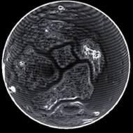
Radius : 2662.33 km - Area : 89.07 Mm²
Temperature : 186 K
Mass : 0.071 Earth Mass
Gravity : 0.406 G
Terraforming : None

Composition : Rock (66.79%), Metal (33.21%), Ice (0%)
Volcanism : No volcanism

Atmosphere : Thin Carbon dioxide
Pressure : 0.006 atm
 Materials :
    iron (21.29%)
    nickel (16.1%)
    sulphur (14.95%)
    carbon (12.57%)
    chromium (9.58%)
    manganese (8.79%)
    phosphorus (8.05%)
    vanadium (5.23%)
    niobium (1.46%)
    molybdenum (1.39%)
    polonium (0.6%)


Last update with EDSM : 3308-12-04 06:16:31


POI : Surface Station
Type : Crater Outpost
Name : Menzies Holdings
Coordinates : (-4.9704,100.0196) 2D 3D
First discovered for ExTool : T'Verez

DatePlanetNear coordinateDist2D3DTypeTXT1
3308-09-10 16:57:46Wayutabal A 2(-4.9769,100.0372)0 s2D3DSurfSurfaceStation - Menzies Holdings - 3790999040
3308-09-10 16:56:43Wayutabal A 2(-4.8586,99.2887)0 s2D3DStlmtMenzies Holdings - (-4.9704,100.0196) - 3790999040
3307-08-24 06:45:02Wayutabal A 2(-4.9673,99.9875)0 s2D3DSurfSurfaceStation - Menzies Holdings - 3790999040
3307-08-24 06:43:48Wayutabal A 2(-5.6667,100.4635)0 s2D3DStlmtMenzies Holdings - (-4.9704,100.0196) - 3790999040


Original idea by SteFBlood & Sileo
Developed by Sileo
Planetary map by NASA WorldWind
Celestial map by D3-Celestial
Thx to Wing Atlantis, CMDR EfilOne, CMDR tonio-GMNH & CMDR Derek Windstorm