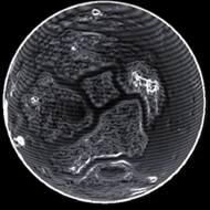
| Date | Planet | Near coordinate | Dist | 2D | 3D | Type | TXT1 |
|---|
| 3308-11-20 15:30:49 | LHS 1541 C 4 | (14.0819,-132.0129) | 0 s | 2D | 3D | Orga | Sample - $Codex_Ent_Stratum_07_Name; |
| 3308-11-20 15:29:33 | LHS 1541 C 4 | (14.0417,-131.9458) | 0 s | 2D | 3D | Orga | Sample - $Codex_Ent_Stratum_07_Name; |
| 3308-11-20 15:28:50 | LHS 1541 C 4 | (14.0332,-131.9169) | 0 s | 2D | 3D | Orga | Log - $Codex_Ent_Stratum_07_Name; |
| 3308-11-13 01:00:55 | LHS 1541 C 4 | (50.7395,24.1503) | 0 s | 2D | 3D | Orga | Sample - $Codex_Ent_Stratum_07_Name; |
| 3308-11-13 00:59:43 | LHS 1541 C 4 | (50.7644,24.1127) | 0 s | 2D | 3D | Orga | Sample - $Codex_Ent_Stratum_07_Name; |
| 3308-11-13 00:58:29 | LHS 1541 C 4 | (50.7734,24.1641) | 0 s | 2D | 3D | Orga | Log - $Codex_Ent_Stratum_07_Name; |
| 3308-10-09 13:32:55 | LHS 1541 C 4 | (-16.1403,44.0495) | 0 s | 2D | 3D | Orga | Sample - $Codex_Ent_Stratum_07_Name; |
| 3308-10-09 13:32:02 | LHS 1541 C 4 | (-16.1328,44.0917) | 0 s | 2D | 3D | Orga | Sample - $Codex_Ent_Stratum_07_Name; |
| 3308-10-09 13:29:26 | LHS 1541 C 4 | (-16.1205,44.1649) | 0 s | 2D | 3D | Orga | Log - $Codex_Ent_Stratum_07_Name; |
| 3308-10-09 13:28:45 | LHS 1541 C 4 | (-16.1212,44.1664) | 0 s | 2D | 3D | Codex | $Codex_Ent_Stratum_07_T_Name; - 2420705 |
| 3308-09-19 02:27:03 | LHS 1541 C 4 | (-54.7839,159.0724) | 0 s | 2D | 3D | Orga | Log - $Codex_Ent_Stratum_07_Name; |
| 3308-09-19 02:15:25 | LHS 1541 C 4 | (-50.2825,145.9252) | 0 s | 2D | 3D | Orga | Log - $Codex_Ent_Stratum_07_Name; |
| 3308-08-13 20:00:22 | LHS 1541 C 4 | (3.9342,30.2062) | 0 s | 2D | 3D | Orga | Sample - $Codex_Ent_Stratum_07_Name; |
| 3308-08-13 19:58:59 | LHS 1541 C 4 | (3.9188,30.2294) | 0 s | 2D | 3D | Orga | Sample - $Codex_Ent_Stratum_07_Name; |
| 3308-08-13 19:58:37 | LHS 1541 C 4 | (3.9191,30.2294) | 0 s | 2D | 3D | Codex | $Codex_Ent_Stratum_07_T_Name; - 2420705 |
| 3308-08-13 19:57:32 | LHS 1541 C 4 | (3.8893,30.2249) | 0 s | 2D | 3D | Codex | $Codex_Ent_Stratum_07_T_Name; - 2420705 |
| 3308-08-13 19:57:32 | LHS 1541 C 4 | (3.8893,30.2249) | 0 s | 2D | 3D | Orga | Log - $Codex_Ent_Stratum_07_Name; |
| 3308-06-25 03:27:37 | LHS 1541 C 4 | (0.5581,-42.3495) | 0 s | 2D | 3D | Orga | Sample - $Codex_Ent_Stratum_07_Name; |
| 3308-06-25 03:26:48 | LHS 1541 C 4 | (0.5475,-42.3093) | 0 s | 2D | 3D | Orga | Sample - $Codex_Ent_Stratum_07_Name; |
| 3308-06-25 03:25:54 | LHS 1541 C 4 | (0.5447,-42.2899) | 0 s | 2D | 3D | Orga | Log - $Codex_Ent_Stratum_07_Name; |
| 3308-06-25 03:25:08 | LHS 1541 C 4 | (0.5448,-42.2879) | 0 s | 2D | 3D | Codex | $Codex_Ent_Stratum_07_T_Name; - 2420705 |
| 3308-03-17 20:47:51 | LHS 1541 C 4 | (6.2008,-17.9693) | 0 s | 2D | 3D | Orga | Sample - $Codex_Ent_Stratum_07_Name; |
| 3308-03-17 20:46:48 | LHS 1541 C 4 | (6.1483,-18.0287) | 0 s | 2D | 3D | Orga | Sample - $Codex_Ent_Stratum_07_Name; |
| 3308-03-17 20:45:35 | LHS 1541 C 4 | (6.0844,-18.0856) | 0 s | 2D | 3D | Orga | Log - $Codex_Ent_Stratum_07_Name; |
| 3308-03-16 16:14:53 | LHS 1541 C 4 | (5.1139,-17.0064) | 0 s | 2D | 3D | Orga | Sample - $Codex_Ent_Stratum_07_Name; |
| 3308-03-16 16:13:31 | LHS 1541 C 4 | (5.1224,-17.0388) | 0 s | 2D | 3D | Orga | Sample - $Codex_Ent_Stratum_07_Name; |
| 3308-03-16 16:11:30 | LHS 1541 C 4 | (5.1579,-16.9985) | 0 s | 2D | 3D | Orga | Log - $Codex_Ent_Stratum_07_Name; |
| 3308-03-16 16:11:00 | LHS 1541 C 4 | (5.1592,-16.9965) | 0 s | 2D | 3D | Codex | $Codex_Ent_Stratum_07_T_Name; - 2420705 |
| 3308-03-15 00:37:36 | LHS 1541 C 4 | (5.8494,15.3258) | 0 s | 2D | 3D | Orga | Sample - $Codex_Ent_Stratum_07_Name; |
| 3308-03-15 00:33:25 | LHS 1541 C 4 | (5.7866,15.303) | 0 s | 2D | 3D | Orga | Sample - $Codex_Ent_Stratum_07_Name; |
| 3308-03-15 00:30:44 | LHS 1541 C 4 | (5.8127,15.2975) | 0 s | 2D | 3D | Orga | Log - $Codex_Ent_Stratum_07_Name; |
| 3308-02-19 12:07:13 | LHS 1541 C 4 | (-36.5345,-42.2776) | 0 s | 2D | 3D | Orga | Sample - $Codex_Ent_Stratum_07_Name; |
| 3308-02-19 12:03:52 | LHS 1541 C 4 | (-36.4414,-42.1746) | 0 s | 2D | 3D | Orga | Sample - $Codex_Ent_Stratum_07_Name; |
| 3308-02-19 11:59:40 | LHS 1541 C 4 | (-36.3765,-42.0795) | 0 s | 2D | 3D | Orga | Log - $Codex_Ent_Stratum_07_Name; |
| 3307-11-30 02:06:39 | LHS 1541 C 4 | (36.6263,7.9492) | 0 s | 2D | 3D | Orga | Sample - $Codex_Ent_Stratum_07_Name; |
| 3307-11-30 02:03:11 | LHS 1541 C 4 | (36.6657,7.9022) | 0 s | 2D | 3D | Codex | $Codex_Ent_Stratum_07_T_Name; - 2420705 |
| 3307-10-17 20:23:16 | LHS 1541 C 4 | (-14.0436,67.0218) | 0 s | 2D | 3D | Orga | Sample - $Codex_Ent_Stratum_07_Name; |
| 3307-10-17 20:22:30 | LHS 1541 C 4 | (-14.0089,67.0495) | 0 s | 2D | 3D | Orga | Sample - $Codex_Ent_Stratum_07_Name; |
| 3307-10-17 20:21:40 | LHS 1541 C 4 | (-13.9741,67.0541) | 0 s | 2D | 3D | Orga | Log - $Codex_Ent_Stratum_07_Name; |
| 3307-10-17 20:21:17 | LHS 1541 C 4 | (-13.9705,67.0543) | 0 s | 2D | 3D | Codex | $Codex_Ent_Stratum_07_T_Name; - 2420705 |
| 3307-10-03 18:05:00 | LHS 1541 C 4 | (4.961,120.9847) | 0 s | 2D | 3D | Codex | $Codex_Ent_Stratum_07_T_Name; - 2420705 |
| 3307-10-03 17:18:51 | LHS 1541 C 4 | (-21.0697,125.1731) | 0 s | 2D | 3D | Orga | Sample - $Codex_Ent_Stratum_07_Name; |
| 3307-10-03 17:17:53 | LHS 1541 C 4 | (-21.078,125.1959) | 0 s | 2D | 3D | Orga | Sample - $Codex_Ent_Stratum_07_Name; |
| 3307-10-03 17:13:55 | LHS 1541 C 4 | (-21.1286,125.199) | 0 s | 2D | 3D | Codex | $Codex_Ent_Stratum_07_T_Name; - 2420705 |
| 3307-10-03 17:13:55 | LHS 1541 C 4 | (-21.1286,125.199) | 0 s | 2D | 3D | Orga | Log - $Codex_Ent_Stratum_07_Name; |
| 3307-08-27 20:34:24 | LHS 1541 C 4 | (-20.1357,100.4631) | 0 s | 2D | 3D | Orga | Sample - $Codex_Ent_Stratum_07_Name; |
| 3307-08-27 20:33:02 | LHS 1541 C 4 | (-20.0425,100.4522) | 0 s | 2D | 3D | Orga | Sample - $Codex_Ent_Stratum_07_Name; |
| 3307-08-27 20:32:10 | LHS 1541 C 4 | (-20.002,100.4485) | 0 s | 2D | 3D | Orga | Log - $Codex_Ent_Stratum_07_Name; |
 iron (24.16%)
 zinc (6.57%)
 selenium (2.71%)
 molybdenum (1.58%)
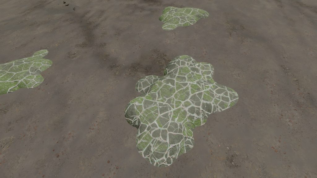 Low-lying photosynthetic organisms that bond tightly to the surface of rocks. The body of the organism may be embedded in the rock subsurface to provide protection from the elements, leaving the tough photosynthetic proto-leaves exposed. Their simple proto-evolutionary nature means that they are a common sight on rocky worlds. Colouration is driven by a mixture of the mineral content of the attached rock and the absorption spectral of the nearby stellar body.