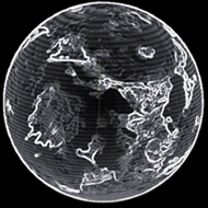
| Date | Planet | Near coordinate | Dist | 2D | 3D | Type | TXT1 |
|---|
| 3308-07-10 22:32:51 | Cooke | (-40.1895,147.3078) | 0 s | 2D | 3D | Stlmt | Haller City - (-40.1895,147.3853) - 3534967808 |
| 3308-07-10 22:20:37 | Cooke | (-40.4287,145.9493) | 0 s | 2D | 3D | Stlmt | Haller City - (-40.1895,147.3853) - 3534967808 |
| 3308-07-10 22:17:09 | Cooke | (-40.1927,147.3387) | 0 s | 2D | 3D | Stlmt | Haller City - (-40.1895,147.3853) - 3534967808 |
| 3308-07-10 21:59:49 | Cooke | (-40.2249,147.172) | 0 s | 2D | 3D | Stlmt | Haller City - (-40.1895,147.3853) - 3534967808 |
| 3308-07-10 21:56:06 | Cooke | (-40.2124,147.3113) | 0 s | 2D | 3D | Stlmt | Haller City - (-40.1895,147.3853) - 3534967808 |
| 3308-07-10 21:52:43 | Cooke | (-40.2072,147.3084) | 0 s | 2D | 3D | Stlmt | Haller City - (-40.1895,147.3853) - 3534967808 |
| 3308-07-10 21:48:23 | Cooke | (-40.2226,147.3857) | 0 s | 2D | 3D | Stlmt | Haller City - (-40.1895,147.3853) - 3534967808 |
| 3308-07-10 21:45:07 | Cooke | (-40.2026,147.2806) | 0 s | 2D | 3D | Stlmt | Haller City - (-40.1895,147.3853) - 3534967808 |
| 3308-07-10 21:42:33 | Cooke | (-40.2143,147.2215) | 0 s | 2D | 3D | Stlmt | Haller City - (-40.1895,147.3853) - 3534967808 |
| 3308-07-10 21:38:23 | Cooke | (-40.2342,147.483) | 0 s | 2D | 3D | Surf | SurfaceStation - Haller City - 3534967808 |
| 3308-07-10 21:27:46 | Cooke | (-44.2725,147.8876) | 0 s | 2D | 3D | Stlmt | Haller City - (-40.1895,147.3853) - 3534967808 |
| 3308-07-10 20:57:54 | Cooke | (-40.104,147.3576) | 0 s | 2D | 3D | Surf | SurfaceStation - Haller City - 3534967808 |
| 3308-07-10 20:11:41 | Cooke | (-40.1198,147.4605) | 0 s | 2D | 3D | Surf | SurfaceStation - Haller City - 3534967808 |
| 3308-07-10 20:09:48 | Cooke | (-43.0318,148.0496) | 0 s | 2D | 3D | Stlmt | Haller City - (-40.1895,147.3853) - 3534967808 |
| 3308-07-10 19:42:39 | Cooke | (-39.4318,145.0401) | 0 s | 2D | 3D | Stlmt | Haller City - (-40.1895,147.3853) - 3534967808 |
| 3308-02-01 01:01:03 | Cooke | (-40.1327,147.3045) | 0 s | 2D | 3D | Surf | SurfaceStation - Haller City - 3534967808 |
| 3308-02-01 00:51:49 | Cooke | (-37.8373,152.1328) | 0 s | 2D | 3D | Stlmt | Haller City - (-40.1895,147.3853) - 3534967808 |
| 3307-12-07 04:36:29 | Cooke | (-42.3572,142.5536) | 0 s | 2D | 3D | Stlmt | Haller City - (-40.1895,147.3853) - 3534967808 |
| 3307-09-29 18:09:37 | Cooke | (-40.1287,147.4734) | 0 s | 2D | 3D | Surf | SurfaceStation - Haller City - 3534967808 |
| 3307-09-29 12:51:22 | Cooke | (-40.109,147.4293) | 0 s | 2D | 3D | Stlmt | Haller City - (-40.1895,147.3853) - 3534967808 |
| 3307-09-29 12:48:04 | Cooke | (-40.1058,147.431) | 0 s | 2D | 3D | Surf | SurfaceStation - Haller City - 3534967808 |
| 3307-09-29 12:41:52 | Cooke | (-40.1118,147.4466) | 0 s | 2D | 3D | Surf | SurfaceStation - Haller City - 3534967808 |
| 3307-09-29 12:40:39 | Cooke | (-42.5503,150.3351) | 0 s | 2D | 3D | Stlmt | Haller City - (-40.1895,147.3853) - 3534967808 |
| 3307-09-29 12:27:47 | Cooke | (-41.9617,143.8282) | 0 s | 2D | 3D | Stlmt | Haller City - (-40.1895,147.3853) - 3534967808 |
| 3307-08-08 21:09:48 | Cooke | (-40.2521,147.3106) | 0 s | 2D | 3D | Surf | SurfaceStation - Haller City - 3534967808 |
| 3307-08-08 21:08:16 | Cooke | (-39.9779,147.6119) | 0 s | 2D | 3D | Stlmt | Haller City - (-40.1895,147.3853) - 3534967808 |
| 3305-06-17 15:25:03 | Cooke | (13.3099,-112.7537) | 4 s | 2D | 3D | Surf | SurfaceStation - Haller City - 3534967808 |
| 3305-06-17 15:23:31 | Cooke | (13.5153,-109.4486) | 0 s | 2D | 3D | Stlmt | Haller City - (13.2261,-112.7275) - 3534967808 |
| 3305-06-15 19:52:13 | Cooke | (13.1731,-112.6607) | 8 s | 2D | 3D | Surf | SurfaceStation - Haller City - 3534967808 |
| 3305-06-15 19:12:45 | Cooke | (13.2674,-112.8068) | 18 s | 2D | 3D | Surf | SurfaceStation - Haller City - 3534967808 |
| 3305-06-15 19:03:53 | Cooke | (14.0853,-112.1689) | 0 s | 2D | 3D | Stlmt | Haller City - (13.2261,-112.7275) - 3534967808 |
| 3305-06-15 19:02:55 | Cooke | (22.3078,-106.0592) | 4 s | 2D | 3D | Stlmt | Haller City - (13.2261,-112.7275) - 3534967808 |
| 3305-05-30 05:02:48 | Cooke | (13.2608,-112.6465) | 2 s | 2D | 3D | Stlmt | Haller City - (13.2261,-112.7275) - 3534967808 |
| 3305-05-30 05:00:56 | Cooke | (13.2673,-112.6487) | 0 s | 2D | 3D | Surf | SurfaceStation - Haller City - 3534967808 |
| 3305-05-30 04:59:16 | Cooke | (15.9971,-110.0675) | 0 s | 2D | 3D | Stlmt | Haller City - (13.2261,-112.7275) - 3534967808 |
| 3305-05-15 12:13:07 | Cooke | (11.2405,-113.0557) | 2 s | 2D | 3D | Stlmt | Haller City - (13.2261,-112.7275) - 3534967808 |
| 3305-05-15 12:12:37 | Cooke | (12.319,-112.9681) | 0 s | 2D | 3D | Stlmt | Haller City - (13.2261,-112.7275) - 3534967808 |
| 3305-05-15 12:12:17 | Cooke | (12.8901,-112.813) | 0 s | 2D | 3D | Stlmt | Haller City - (13.2261,-112.7275) - 3534967808 |
| 3305-05-15 12:08:21 | Cooke | (13.1393,-112.7363) | 0 s | 2D | 3D | Surf | SurfaceStation - Haller City - 3534967808 |
| 3305-05-15 12:06:20 | Cooke | (17.8923,-111.95) | 0 s | 2D | 3D | Stlmt | Haller City - (13.2261,-112.7275) - 3534967808 |
| 3304-11-04 20:01:01 | Cooke | (13.3121,-112.7191) | 12 s | 2D | 3D | Surf | SurfaceStation - Haller City - 3534967808 |

 iron (19.88%)
 sulphur (16.32%)
 nickel (15.04%)
 carbon (13.72%)
 chromium (8.94%)
 phosphorus (8.79%)
 manganese (8.21%)
 zinc (5.4%)
 niobium (1.36%)
 tellurium (1.24%)
 tungsten (1.09%)