| Date | Planet | Near coordinate | Dist | 2D | 3D | Type | TXT1 |
|---|
| 3308-07-31 16:06:50 | Blatrimpe 7 | (34.6931,36.8354) | 0 s | 2D | 3D | Stlmt | Koch Beacon - (34.5267,37.1240) - 3533481984 |
| 3308-07-31 15:23:56 | Blatrimpe 7 | (34.8243,36.8129) | 0 s | 2D | 3D | Stlmt | Koch Beacon - (34.5267,37.1240) - 3533481984 |
| 3308-07-31 08:58:33 | Blatrimpe 7 | (34.5416,37.1327) | 0 s | 2D | 3D | Surf | SurfaceStation - Koch Beacon - 3533481984 |
| 3308-07-31 08:57:40 | Blatrimpe 7 | (34.6406,36.8939) | 0 s | 2D | 3D | Stlmt | Koch Beacon - (34.5267,37.1240) - 3533481984 |
| 3308-07-30 22:42:24 | Blatrimpe 7 | (34.8272,36.6186) | 0 s | 2D | 3D | Stlmt | Koch Beacon - (34.5267,37.1240) - 3533481984 |
| 3308-07-30 18:17:09 | Blatrimpe 7 | (34.3863,36.8586) | 0 s | 2D | 3D | Stlmt | Koch Beacon - (34.5267,37.1240) - 3533481984 |
| 3308-07-30 17:21:15 | Blatrimpe 7 | (34.5065,36.69) | 0 s | 2D | 3D | Stlmt | Koch Beacon - (34.5267,37.1240) - 3533481984 |
| 3308-07-30 16:52:09 | Blatrimpe 7 | (34.611,36.848) | 0 s | 2D | 3D | Stlmt | Koch Beacon - (34.5267,37.1240) - 3533481984 |
| 3308-07-30 15:50:29 | Blatrimpe 7 | (34.6439,36.7563) | 0 s | 2D | 3D | Stlmt | Koch Beacon - (34.5267,37.1240) - 3533481984 |
| 3308-07-30 14:32:33 | Blatrimpe 7 | (34.5372,37.1397) | 0 s | 2D | 3D | Surf | SurfaceStation - Koch Beacon - 3533481984 |
| 3308-07-30 14:31:46 | Blatrimpe 7 | (34.8415,37.1163) | 0 s | 2D | 3D | Stlmt | Koch Beacon - (34.5267,37.1240) - 3533481984 |
| 3308-07-29 17:12:16 | Blatrimpe 7 | (34.3255,36.9275) | 0 s | 2D | 3D | Stlmt | Koch Beacon - (34.5267,37.1240) - 3533481984 |
| 3308-07-26 22:45:58 | Blatrimpe 7 | (34.5131,37.1127) | 0 s | 2D | 3D | Surf | SurfaceStation - Koch Beacon - 3533481984 |
| 3308-07-26 22:44:49 | Blatrimpe 7 | (34.7809,36.9777) | 0 s | 2D | 3D | Stlmt | Koch Beacon - (34.5267,37.1240) - 3533481984 |
| 3308-07-26 18:55:49 | Blatrimpe 7 | (34.4763,36.9804) | 0 s | 2D | 3D | Stlmt | Koch Beacon - (34.5267,37.1240) - 3533481984 |
| 3308-07-26 17:55:23 | Blatrimpe 7 | (34.5425,37.1279) | 0 s | 2D | 3D | Surf | SurfaceStation - Koch Beacon - 3533481984 |
| 3308-07-26 17:54:47 | Blatrimpe 7 | (34.766,37.0675) | 0 s | 2D | 3D | Stlmt | Koch Beacon - (34.5267,37.1240) - 3533481984 |
| 3308-07-25 18:14:56 | Blatrimpe 7 | (34.5049,37.153) | 0 s | 2D | 3D | Stlmt | Koch Beacon - (34.5267,37.1240) - 3533481984 |
| 3308-07-25 17:30:10 | Blatrimpe 7 | (34.5415,37.1166) | 0 s | 2D | 3D | Surf | SurfaceStation - Koch Beacon - 3533481984 |
| 3308-07-25 17:29:25 | Blatrimpe 7 | (34.4494,36.7692) | 0 s | 2D | 3D | Stlmt | Koch Beacon - (34.5267,37.1240) - 3533481984 |
| 3308-07-25 16:41:16 | Blatrimpe 7 | (34.5403,37.1353) | 0 s | 2D | 3D | Surf | SurfaceStation - Koch Beacon - 3533481984 |
| 3308-07-25 16:40:09 | Blatrimpe 7 | (34.5281,37.1169) | 0 s | 2D | 3D | Stlmt | Koch Beacon - (34.5267,37.1240) - 3533481984 |
| 3308-07-24 16:17:39 | Blatrimpe 7 | (34.5107,37.1239) | 0 s | 2D | 3D | Surf | SurfaceStation - Koch Beacon - 3533481984 |
| 3308-07-24 16:16:56 | Blatrimpe 7 | (34.4346,37.0338) | 0 s | 2D | 3D | Stlmt | Koch Beacon - (34.5267,37.1240) - 3533481984 |
| 3308-07-24 11:08:17 | Blatrimpe 7 | (34.359,36.7415) | 0 s | 2D | 3D | Stlmt | Koch Beacon - (34.5267,37.1240) - 3533481984 |
| 3308-07-23 18:23:22 | Blatrimpe 7 | (34.6422,36.8037) | 0 s | 2D | 3D | Stlmt | Koch Beacon - (34.5267,37.1240) - 3533481984 |
| 3308-07-23 17:16:15 | Blatrimpe 7 | (34.5121,37.131) | 0 s | 2D | 3D | Surf | SurfaceStation - Koch Beacon - 3533481984 |
| 3308-07-23 17:15:13 | Blatrimpe 7 | (34.5624,36.827) | 0 s | 2D | 3D | Stlmt | Koch Beacon - (34.5267,37.1240) - 3533481984 |
| 3308-07-23 16:25:23 | Blatrimpe 7 | (34.5164,37.1085) | 0 s | 2D | 3D | Surf | SurfaceStation - Koch Beacon - 3533481984 |
| 3308-07-23 16:24:40 | Blatrimpe 7 | (34.5977,36.92) | 0 s | 2D | 3D | Stlmt | Koch Beacon - (34.5267,37.1240) - 3533481984 |
| 3308-07-20 18:09:52 | Blatrimpe 7 | (34.5118,37.1153) | 0 s | 2D | 3D | Surf | SurfaceStation - Koch Beacon - 3533481984 |
| 3308-07-20 18:08:48 | Blatrimpe 7 | (34.6898,36.9684) | 0 s | 2D | 3D | Stlmt | Koch Beacon - (34.5267,37.1240) - 3533481984 |
| 3308-06-27 02:37:11 | Blatrimpe 7 | (34.5147,37.1105) | 0 s | 2D | 3D | Surf | SurfaceStation - Koch Beacon - 3533481984 |
| 3308-06-27 02:36:08 | Blatrimpe 7 | (34.6179,36.842) | 0 s | 2D | 3D | Stlmt | Koch Beacon - (34.5267,37.1240) - 3533481984 |
| 3308-03-08 10:54:52 | Blatrimpe 7 | (34.5104,37.1278) | 0 s | 2D | 3D | Stlmt | Koch Beacon - (34.5267,37.1240) - 3533481984 |
| 3308-03-08 10:48:34 | Blatrimpe 7 | (34.5119,37.1274) | 0 s | 2D | 3D | Surf | SurfaceStation - Koch Beacon - 3533481984 |
| 3308-03-08 10:47:21 | Blatrimpe 7 | (34.5454,36.5972) | 0 s | 2D | 3D | Stlmt | Koch Beacon - (34.5267,37.1240) - 3533481984 |
| 3307-12-31 04:35:44 | Blatrimpe 7 | (34.5418,37.1242) | 0 s | 2D | 3D | Surf | SurfaceStation - Koch Beacon - 3533481984 |
| 3307-12-31 04:33:54 | Blatrimpe 7 | (34.0851,36.9599) | 0 s | 2D | 3D | Stlmt | Koch Beacon - (34.5267,37.1240) - 3533481984 |
| 3307-10-20 05:25:26 | Blatrimpe 7 | (34.5415,37.1206) | 0 s | 2D | 3D | Surf | SurfaceStation - Koch Beacon - 3533481984 |
| 3307-10-20 05:24:13 | Blatrimpe 7 | (34.4701,37.4822) | 0 s | 2D | 3D | Stlmt | Koch Beacon - (34.5267,37.1240) - 3533481984 |
| 3307-10-19 06:58:16 | Blatrimpe 7 | (34.5116,37.1202) | 0 s | 2D | 3D | Surf | SurfaceStation - Koch Beacon - 3533481984 |
| 3307-10-19 06:56:54 | Blatrimpe 7 | (34.3016,37.2037) | 0 s | 2D | 3D | Stlmt | Koch Beacon - (34.5267,37.1240) - 3533481984 |
| 3307-07-03 04:51:31 | Blatrimpe 7 | (34.5388,37.1375) | 0 s | 2D | 3D | Surf | SurfaceStation - Koch Beacon - 3533481984 |
| 3307-07-03 04:50:21 | Blatrimpe 7 | (34.5432,37.6107) | 0 s | 2D | 3D | Stlmt | Koch Beacon - (34.5267,37.1240) - 3533481984 |
| 3305-01-02 10:57:26 | Blatrimpe 7 | (34.5394,37.1114) | 4 s | 2D | 3D | Surf | SurfaceStation - Koch Beacon - 3533481984 |
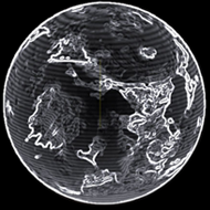
 iron (22.27%)
 nickel (16.84%)
 sulphur (15.85%)
 carbon (13.33%)
 manganese (9.2%)
 phosphorus (8.53%)
 zinc (6.05%)
 germanium (4.64%)
 niobium (1.52%)
 mercury (0.97%)
 technetium (0.8%)