Map Status : None - You need to be logged if you want to do the surface mapping. | Type : Rocky Ice world 
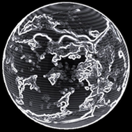
Radius : 3432.11 km - Area : 148.024 Mm² Temperature : 153 K Mass : 0.112 Earth Mass Gravity : 0.388 G Terraforming : None Composition : Rock (49.68%), Ice (26.54%), Metal (23.78%) Volcanism : No volcanism Atmosphere : No atmosphere Pressure : None | Materials : iron (19.15%) sulphur (19.04%) carbon (16.01%) nickel (14.48%) phosphorus (10.25%) manganese (7.91%) zinc (5.2%) vanadium (4.7%) niobium (1.31%) molybdenum (1.25%) technetium (0.68%) |
POI : Surface Station Type : Settlement Name : Hartog Industrial Coordinates : (-50.4395,23.9536) 2D 3D First discovered for ExTool : Vhi |
Date | Planet | Near coordinate | Dist | 2D | 3D | Type | TXT1 |
---|---|---|---|---|---|---|---|
3307-12-26 03:07:20 | Aburu A 7 | (-50.4384,23.9521) | 0 s | 2D | 3D | Surf | SurfaceStation - Hartog Industrial - 3828138240 |
3307-12-26 03:06:30 | Aburu A 7 | (-50.691,24.733) | 0 s | 2D | 3D | Stlmt | Hartog Industrial - (-50.4395,23.9536) - 3828138240 |
3307-10-09 09:10:15 | Aburu A 7 | (-50.6572,22.7473) | 0 s | 2D | 3D | Stlmt | Hartog Industrial - (-50.4395,23.9536) - 3828138240 |
3307-09-21 01:21:02 | Aburu A 7 | (-50.4384,23.9523) | 0 s | 2D | 3D | Surf | SurfaceStation - Hartog Industrial - 3828138240 |
3307-09-21 01:19:34 | Aburu A 7 | (-51.2243,23.8055) | 0 s | 2D | 3D | Stlmt | Hartog Industrial - (-50.4395,23.9536) - 3828138240 |
Original idea by SteFBlood & Sileo Developed by Sileo Planetary map by NASA WorldWind Celestial map by D3-Celestial Thx to Wing Atlantis, CMDR EfilOne, CMDR tonio-GMNH & CMDR Derek Windstorm |