My CMDR name :
My position :
My system :


System : Oduduseri - EDSM
Planet : Oduduseri A 3 a - EDSM


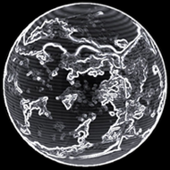
Map Status : None - You need to be logged if you want to do the surface mapping.

 Type : Rocky Ice world
Radius : 1092.72 km - Area : 15.005 Mm²
Temperature : 109 K
Mass : 0.003 Earth Mass
Gravity : 0.101 G
Terraforming : Not terraformable

Composition : Rock (60.58%), Ice (29.48%), Metal (9.94%)
Volcanism : No volcanism

Atmosphere : No atmosphere
Pressure : None
 Materials :
    sulphur (21.45%)
    carbon (18.04%)
    iron (17.72%)
    nickel (13.4%)
    phosphorus (11.55%)
    chromium (7.97%)
    zinc (4.82%)
    arsenic (2.08%)
    tin (1.1%)
    ruthenium (1.09%)
    mercury (0.77%)


Last update with EDSM : 3308-08-31 12:22:07


POI : Surface Station
Type : Settlement
Name : Leighton Drilling Facility
Coordinates : (16.1136,144.0223) 2D 3D
First discovered for ExTool : drag0ri0n

DatePlanetNear coordinateDist2D3DTypeTXT1
3307-08-27 04:10:34Oduduseri A 3 a(16.1357,144.0227)0 s2D3DNearLeighton Drilling Facility
3307-08-27 04:09:45Oduduseri A 3 a(16.1351,144.0228)0 s2D3DNearLeighton Drilling Facility
3307-08-27 04:08:49Oduduseri A 3 a(17.4742,144.1255)0 s2D3DStlmtLeighton Drilling Facility - (16.1136,144.0223) - 3808034816
3307-07-01 05:56:55Oduduseri A 3 a(16.5096,145.1478)0 s2D3DStlmtLeighton Drilling Facility - (16.1136,144.0223) - 3808034816
3307-07-01 05:29:01Oduduseri A 3 a(16.1105,144.0213)0 s2D3DSurfSurfaceStation - Leighton Drilling Facility - 3808034816
3307-07-01 05:27:53Oduduseri A 3 a(16.465,142.5069)0 s2D3DStlmtLeighton Drilling Facility - (16.1136,144.0223) - 3808034816


Original idea by SteFBlood & Sileo
Developed by Sileo
Planetary map by NASA WorldWind
Celestial map by D3-Celestial
Thx to Wing Atlantis, CMDR EfilOne, CMDR tonio-GMNH & CMDR Derek Windstorm