Map Status : None - You need to be logged if you want to do the surface mapping.
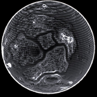
Radius : 827.1 km - Area : 8.597 Mm²
Temperature : 164 K
Mass : 0.002 Earth Mass
Gravity : 0.097 G
Terraforming : Not terraformable
Composition : Rock (91.18%), Metal (8.82%), Ice (0%)
Volcanism : No volcanism
Atmosphere : Thin Carbon dioxide
Pressure : 0.017 atm
 iron (19.59%) sulphur (19.25%) carbon (16.19%) nickel (14.82%) phosphorus (10.36%)
 manganese (8.09%) zinc (5.32%)
 selenium (3.01%)
 niobium (1.34%) yttrium (1.17%) mercury (0.86%)