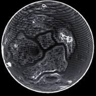
Map Status : None - You need to be logged if you want to do the surface mapping.
Radius : 5342.3 km - Area : 358.646 Mm²
Temperature : 262 K
Mass : 0.653 Earth Mass
Gravity : 0.931 G
Terraforming : Candidate for terraforming
Composition : Rock (66.55%), Metal (33.45%), Ice (0%)
Volcanism : Rocky Magma
Atmosphere : Thin Carbon dioxide
Pressure : 0.008 atm
 iron (21.29%) nickel (16.1%) sulphur (15.07%) carbon (12.67%)
 chromium (9.57%) manganese (8.79%) phosphorus (8.11%) vanadium (5.23%)
 molybdenum (1.39%) tungsten (1.17%)
 polonium (0.6%)