Map Status : None - You need to be logged if you want to do the surface mapping.
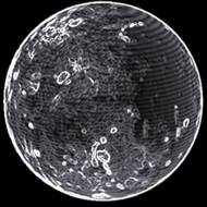
Radius : 705.71 km - Area : 6.258 Mm²
Temperature : 387 K
Mass : 0.001 Earth Mass
Gravity : 0.086 G
Terraforming : None
Composition : Rock (85.95%), Metal (14.05%), Ice (0%)
Volcanism : None
Atmosphere : None
Pressure : None
 iron (19.88%) sulphur (17.79%) nickel (15.04%) carbon (14.96%) phosphorus (9.58%)
 manganese (8.21%) zinc (5.4%) germanium (5.26%)
 tellurium (1.36%)
 molybdenum (1.3%) tin (1.24%)