Map Status : None - You need to be logged if you want to do the surface mapping.
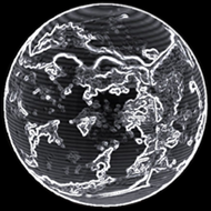
Radius : 2329.36 km - Area : 68.184 Mm²
Temperature : 155 K
Mass : 0.04 Earth Mass
Gravity : 0.302 G
Terraforming : None
Composition : Rock (59.39%), Metal (29.02%), Ice (11.59%)
Volcanism : No volcanism
Atmosphere : No atmosphere
Pressure : None
 iron (21.27%) sulphur (17.92%) nickel (16.09%) carbon (15.07%) phosphorus (9.65%)
 manganese (8.78%) germanium (4.46%) zirconium (2.47%)
 cadmium (1.65%) tin (1.37%)
 yttrium (1.27%)