![]() Map Status : None - You need to be logged if you want to do the surface mapping. Human : 14 | Type : High metal content world 
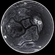
Radius : 3126.15 km - Area : 122.809 Mm² Temperature : 90 K Mass : 0.116 Earth Mass Gravity : 0.484 G Terraforming : Not terraformable Composition : Rock (67.25%), Metal (32.75%), Ice (0%) Volcanism : No volcanism Atmosphere : Thin Nitrogen Pressure : 0.011 atm | Materials : ![]() ![]() ![]() ![]() ![]() ![]() ![]() ![]() ![]() ![]() ![]() |
POI : Surface Station Name : Amaike Dredging Site Coordinates : (-27.6934,-148.8299) 2D 3D First discovered for ExTool : Cruchot1970 |
Date | Planet | Near coordinate | Dist | 2D | 3D | Type | TXT1 |
---|---|---|---|---|---|---|---|
3307-09-16 19:42:35 | Eravarenth A 1 | (-27.6966,-148.8297) | 0 s | 2D | 3D | Near | Amaike Dredging Site |
3307-09-16 19:39:49 | Eravarenth A 1 | (-27.6966,-148.8297) | 0 s | 2D | 3D | Near | Amaike Dredging Site |
3307-09-16 19:38:36 | Eravarenth A 1 | (-28.2861,-148.359) | 0 s | 2D | 3D | Stlmt | Amaike Dredging Site - (-27.6934,-148.8299) - 3872838400 |
3307-09-16 19:04:28 | Eravarenth A 1 | (-27.6829,-148.8304) | 0 s | 2D | 3D | Near | Amaike Dredging Site |
3307-09-16 19:03:27 | Eravarenth A 1 | (-27.153,-148.5326) | 0 s | 2D | 3D | Stlmt | Amaike Dredging Site - (-27.6934,-148.8299) - 3872838400 |
Original idea by SteFBlood & Sileo Developed by Sileo Planetary map by NASA WorldWind Celestial map by D3-Celestial Thx to Wing Atlantis, CMDR EfilOne, CMDR tonio-GMNH & CMDR Derek Windstorm |